
Route and Altitude
In this lesson you’ll continue using the flight from WAJJ-KAS-NOI-NOI-WAVA-WAJJ that you downloaded previously.
First switch back to the version of the flight that you downloaded from FlightSpan™ Ops. From the DFR tab, tap Select New and select the Open WAJJ-KAS-NOI-NOI-WAVA-WAJJ flight number ending in -01.
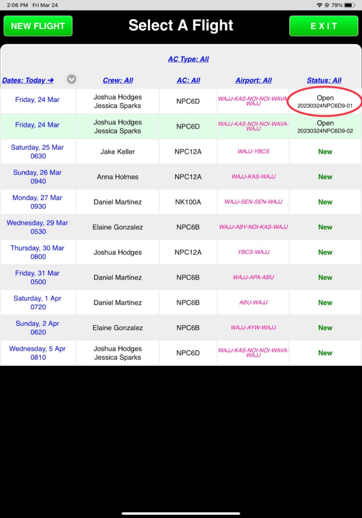
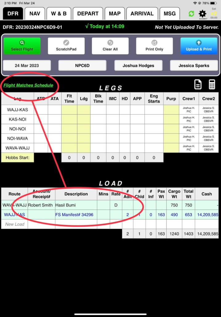
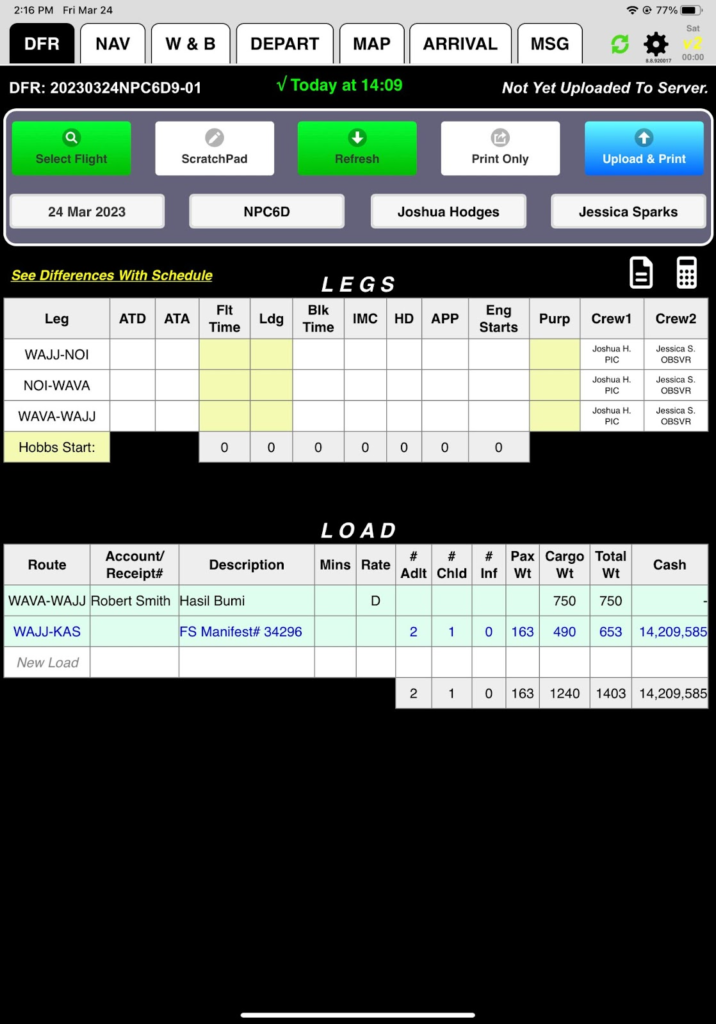
You’ll know you got the right one if you see the Load section filled out and a note saying Flight Matches Schedule.
Editing the Route
The default route between destinations is Direct. There is high terrain between NOI and WAVA, but going via Dagai Pass (DAGPZ) allows you to go lower, so add that to your route.
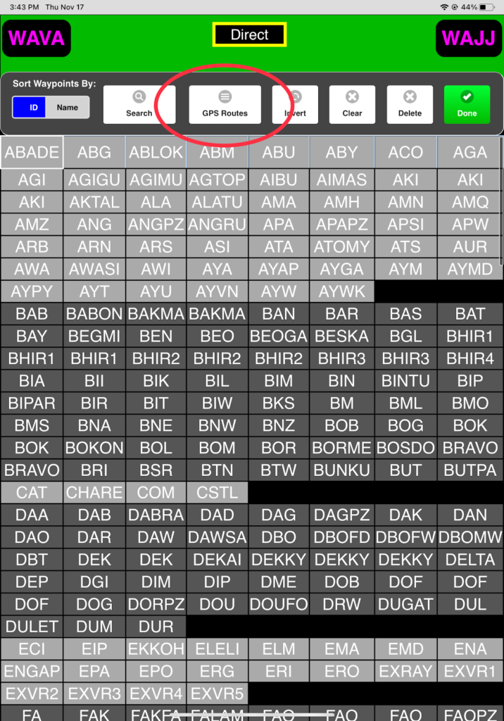
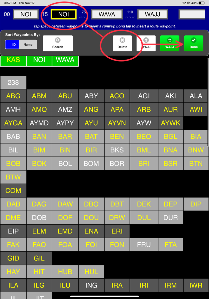
From the NAV Tab, tap on Direct in the Route / Complete column for the NOI-WAVA leg.
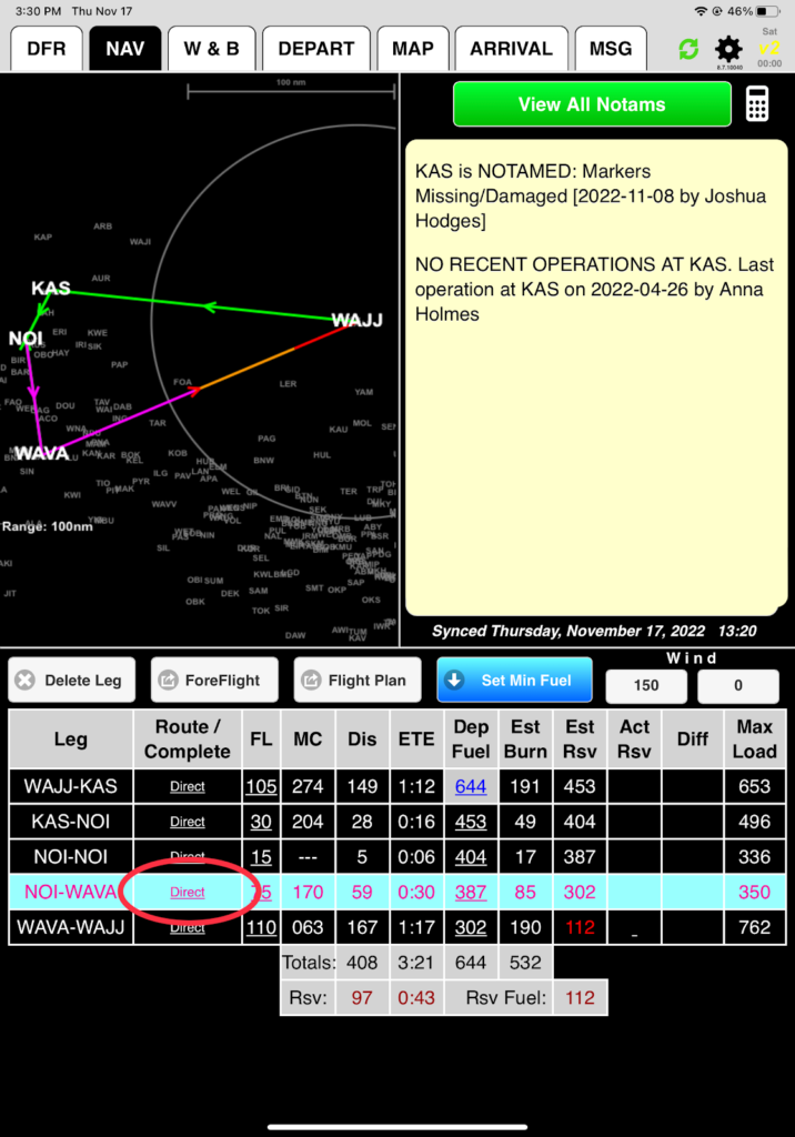
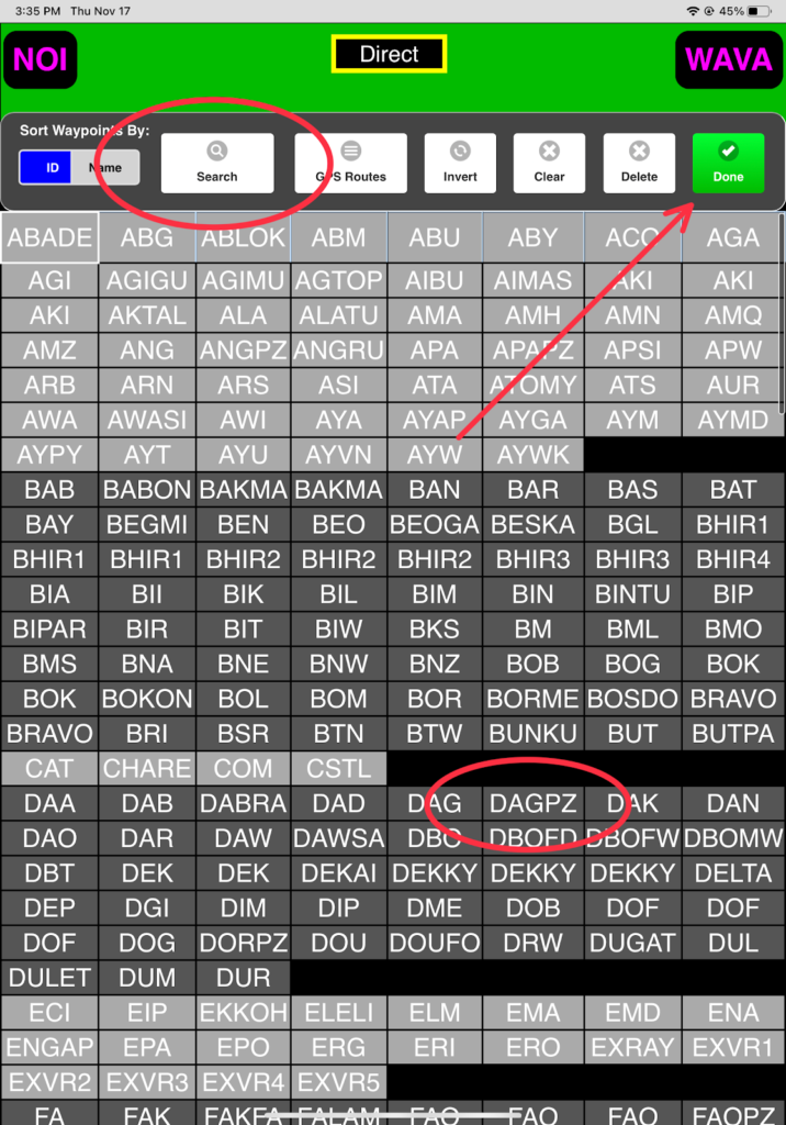
Use either the Search function or select DAGPZ from the list, and tap Done.
There is also high terrain on the WAVA-WAJJ route, with a predefined GPS VFR route.
Tap on Direct in the Route / Complete column for the WAVA-WAJJ leg.

Tap on the GPS Routes button.
Add the VFR route from Jayapura VOR to Mulia via Dorman Pass (DORPZ) by scrolling down and selecting VR3.
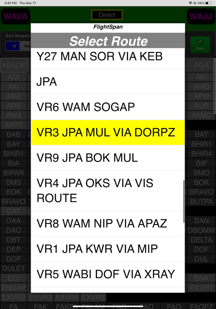
Because the GPS route is from JPA VOR (at the Sentani airport) to Mulia via Dorman Pass, the waypoints are inserted in the reverse order. Tap on Invert to get the correct order.
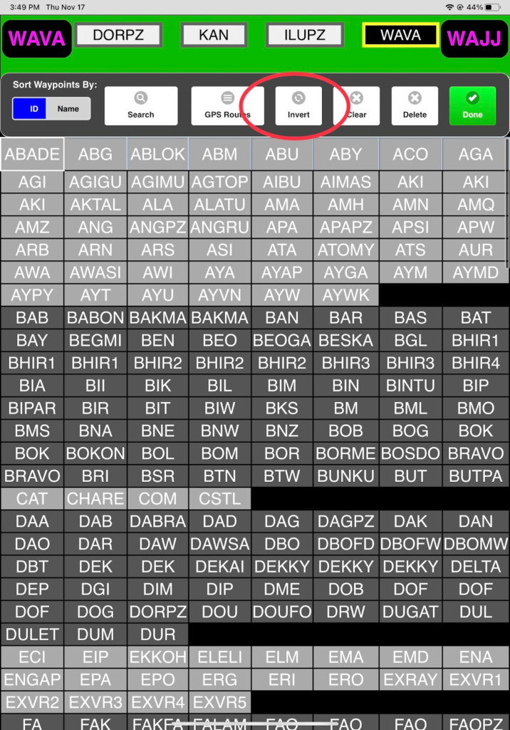
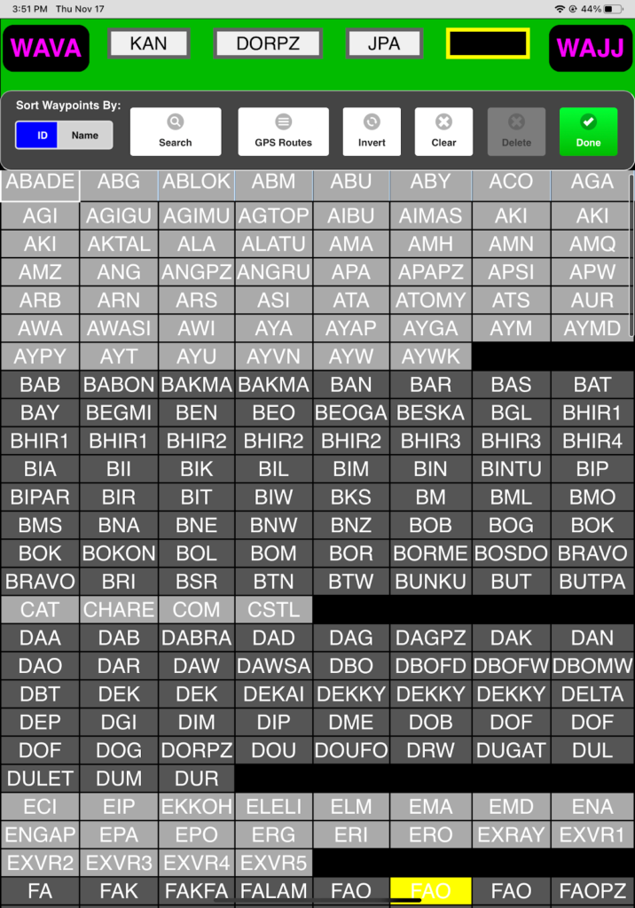
The order of the waypoints is reversed. Tap done to insert it into the route.
Now practice deleting a leg.
There are two ways to do it:
First from the NAV Tab, highlight the WAJJ-KAS leg, then tap on Delete Leg and confirm Yes.
NOTE: For helicopters, this button will be replaced with an ‘Add/Edit LZ’ button and you’ll need to use the 2nd method for deleting a waypoint from a route.

Now delete a leg from the route planner screen: From the Nav tab, highlight a leg, then tap on a leg in the Leg column, and the route planner screen will open. Highlight the waypoint and tap Delete and then Done.
Note that the changes you made are also reflected on the LEGS section of the DFR tab. Use the Refresh / All buttons to restore your flight.
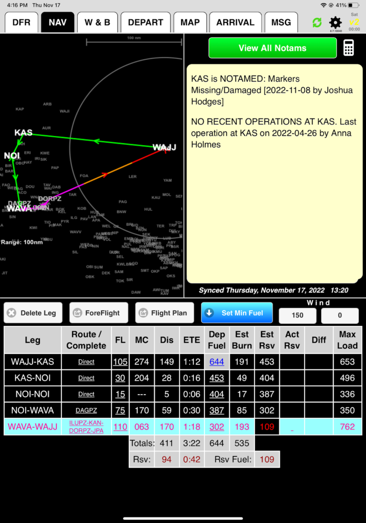
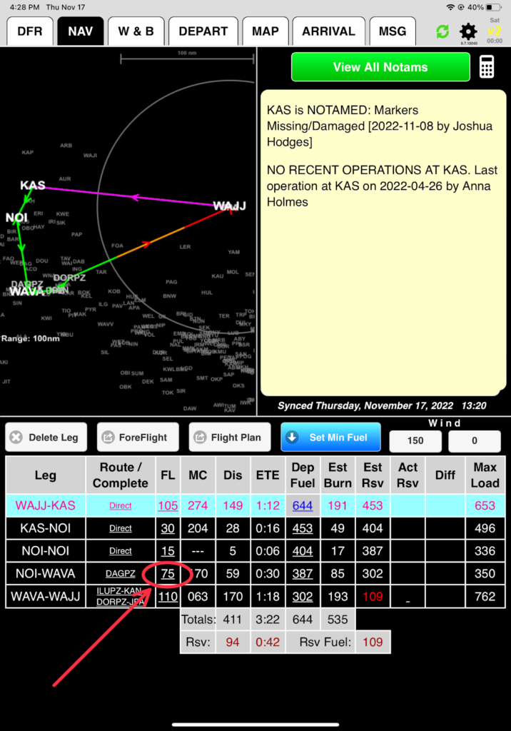
From the NAV tab, you can see that your route is back, but DAGPZ and the V3 GPS route have been removed from the NOI-WAVA-WAJJ legs. Follow the instructions above to put them back in.
If you did it all correctly, this is what you should see:
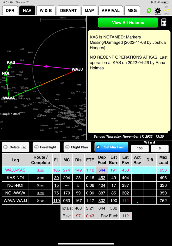
Note that the map is simply a preview of your chosen routes to help you catch incorrect waypoints or fuel planning errors. In this example, an incorrect waypoint was added to the route.
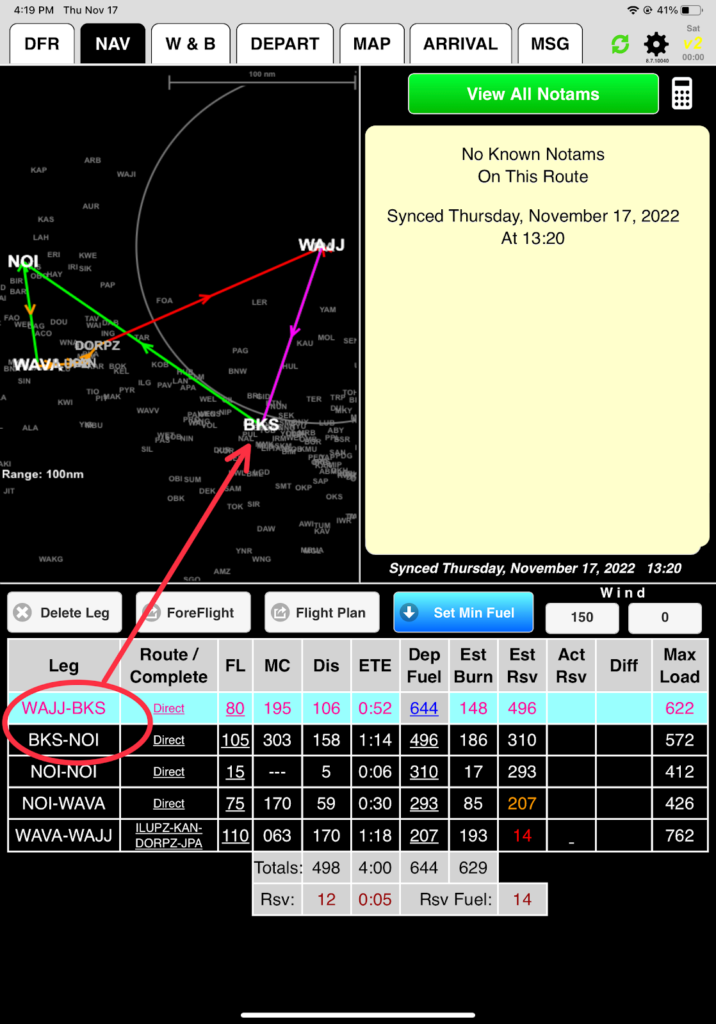
In this example, there is insufficient fuel to fly the route – you will hit reserve level one (reserve levels are set in FlightSpan™ Ops according to your company SOP) on the NOI-WAVA leg, reserve level two on the WAVA-WAJJ leg, and you will run out of fuel before reaching WAJJ.
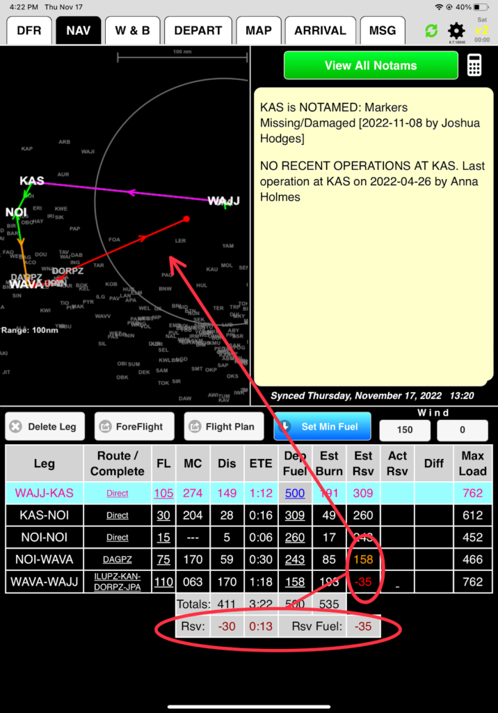
Color coding on the legs on the map indicate which leg is selected and the expected fuel status. Color coding in the Est Rsv column matches.
- Magenta = Active leg with sufficient fuel
- Green = Non-active leg with sufficient fuel
- Orange = Below reserve level one
- Red = Below reserve level two
- Red dot ending the line = Out of fuel
- Arrowhead color = Ultimate fuel state on that leg regardless of the leg color
Setting Altitude
FlightSpan™ does not consider terrain when recommending an altitude since there is no terrain database; it just calculates the most efficient altitude considering time, fuel, and direction of flight. From your experience you know that 11,000 feet is good for Dorman Pass, but 7,500 is too low for Dagai Pass, so tap on the altitude,
And select 9,000. Altitudes may be chosen in 500 foot increments
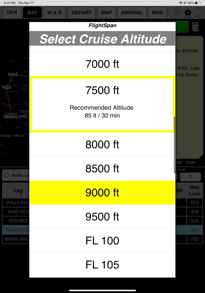
Note: In FlightSpan™ Ops, you have the option of setting the default cruise altitude system to VFR, IFR, or four quadrant altitudes.
Next we’ll look at how to plan fuel requirements.
Video Version