
Top bar, left to right
- Groundspeed
- Bearing to the next waypoint / Current Track
- Distance to Destination
- Current Route Segment
- Estimated Time En Route
- Actual Time of Departure
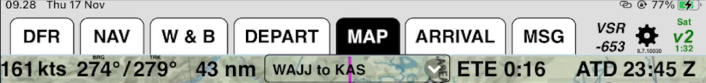
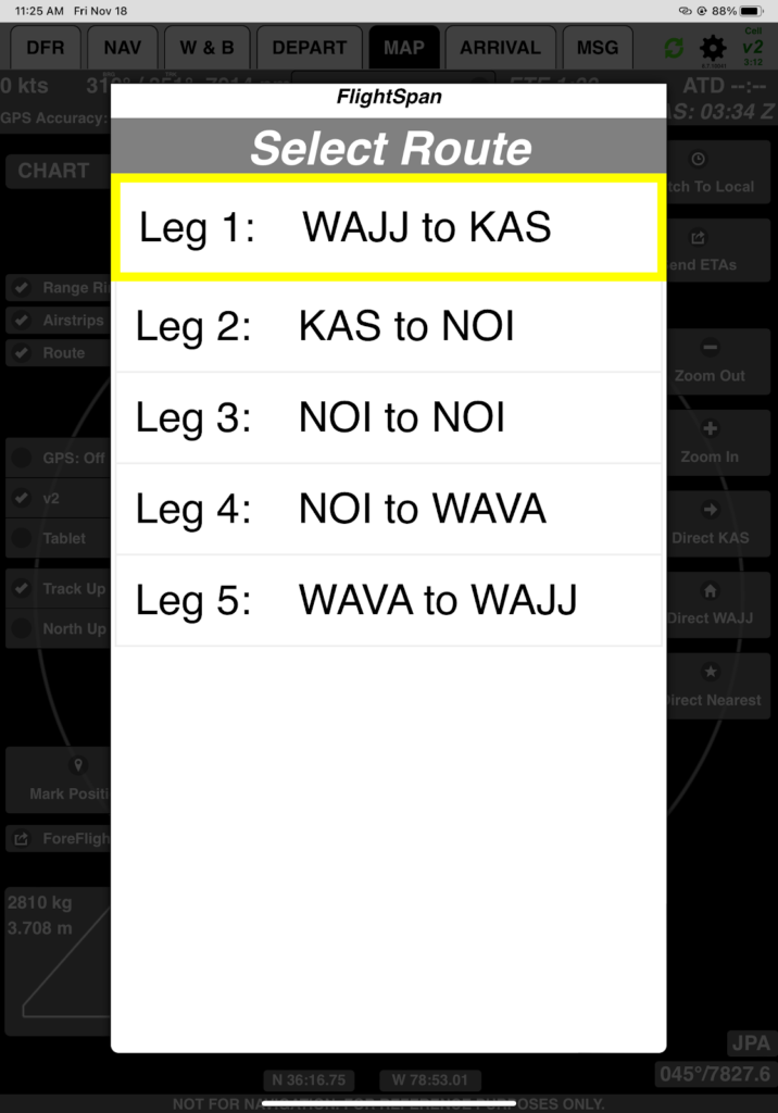
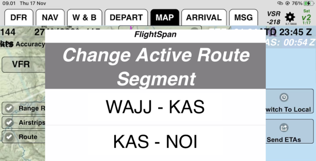
If you tap the drop down arrow next to the route segment, you can select which route segment is displayed, which can be useful if you want to know the bearing to a destination, or if you want to navigate to a waypoint on that route segment.
Left Side, top to bottom
GPS accuracy indicates green with a good signal, and as the signal degrades the bar will turn yellow, then red. Any time the GPS signal is poor (not green) a GPS accuracy warning will pop up.
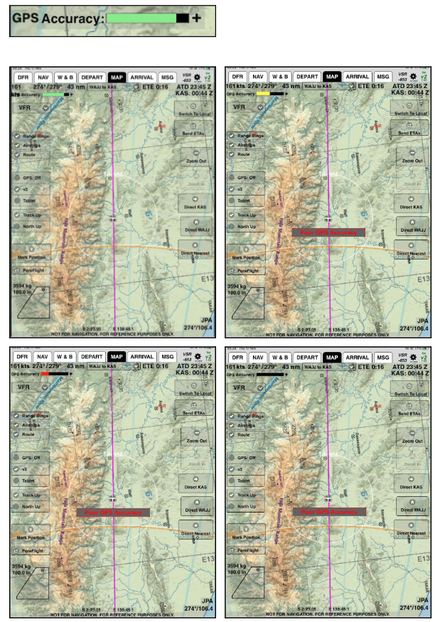
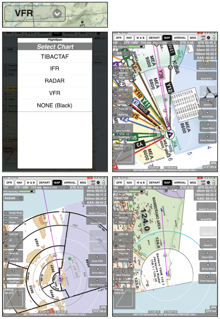
CHART – Tap the dropdown arrow to select charts loaded from FlightSpan™ Ops (selections below are examples only).
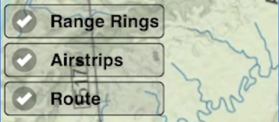
Switch on or off:
- Range rings 30, 60, and 100 nm from home base
- Runways displaying on the chart
- Route lines displaying on the chart
Switch GPS Source between:
- Off – no position information. (It turns yellow to serve as a GPS status indicator.)
- v2track
- Tablet (iPad)

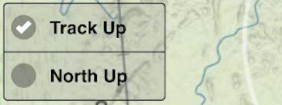
Change Map Orientation between:
- Track up
- North up
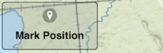
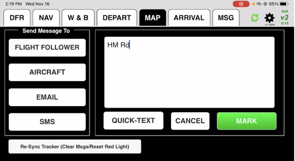
Mark and store your current position at the moment you tap the button. It will ask if you want to add a description. If you select Yes, it will take you to the MSG tab. Enter the description, then tap Mark.
Export the route (All or Current Leg) to ForeFlight, just as you did from the NAV tab.

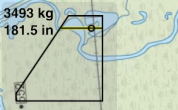
The CG envelope displays your departure weight and balance.
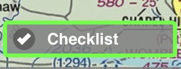
The Checklist button can be used to open the climb checklist at any time. The button is color coded to give you feedback on the status of the climb checklist for the active leg. There are four distinct statuses:
- Gray – Pre or post flight status. (Trip Manifest has not been sent, or On the Ground has been reported.)
- Blue – Armed. The trip manifest has been sent, but the aircraft hasn’t climbed through the checklist altitude yet.
- Yellow – The checklist was either opened automatically or by the pilot, but is incomplete.
- Green – The checklist is complete.
Right Side, top to bottom
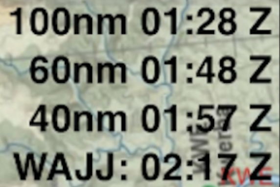
ETA at each waypoint to your next destination
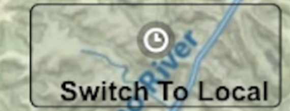
Switch between Local and Zulu time
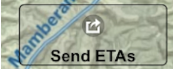
- Send your ETAs to v2Track
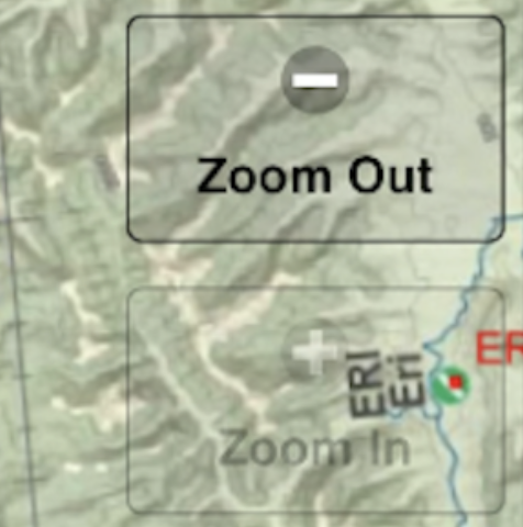
Zoom the map In and Out
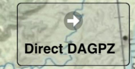
Direct Buttons
The first Direct button defaults to the next waypoint in your route.
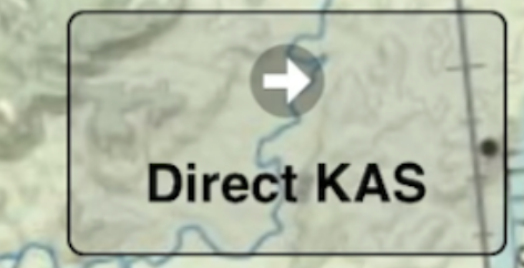
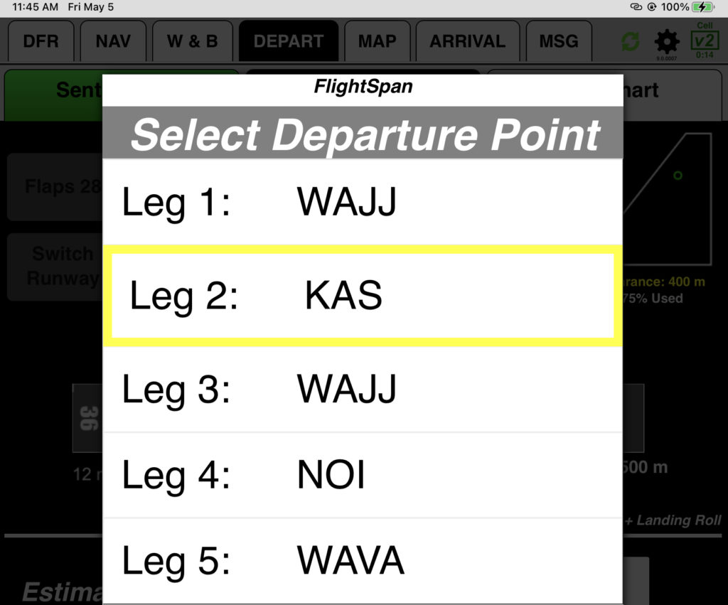
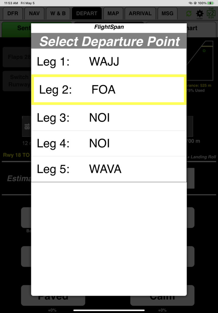
If you wish to navigate direct to a different waypoint, tap the dropdown arrow next to your route segment, then select the desired route segment.
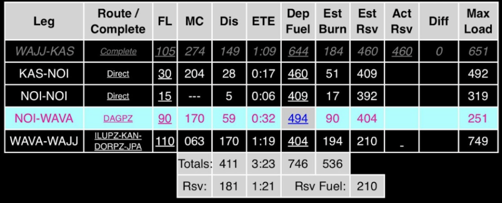
The direct button will change to the next waypoint on the chosen route. If you choose NOI-WAVA, it will take you directly to DAGPZ.
No changes will be made to the Nav or DFR tabs, except the active leg will be highlighted on the Nav tab.
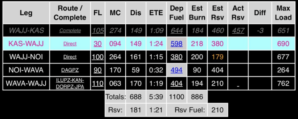
Direct Home takes you directly back to home base.
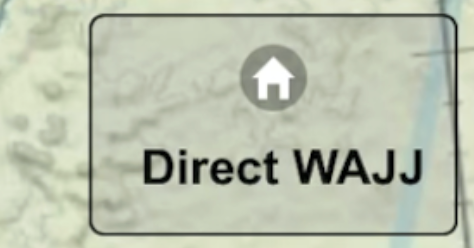
The destination you are navigating to will be replaced with home base on the Nav, DFR, W&B and Performance tabs. In this case, Direct WAJJ was tapped while navigating KAS-NOI.
Direct Nearest pulls up the 10 nearest runways. You can see the full list of runways by scrolling to the bottom and selecting See Full List, which takes you to the route planner screen.
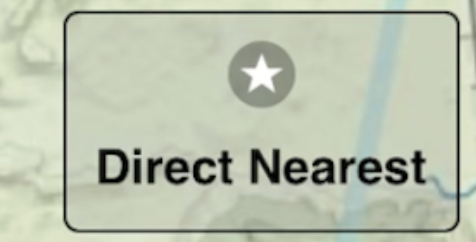
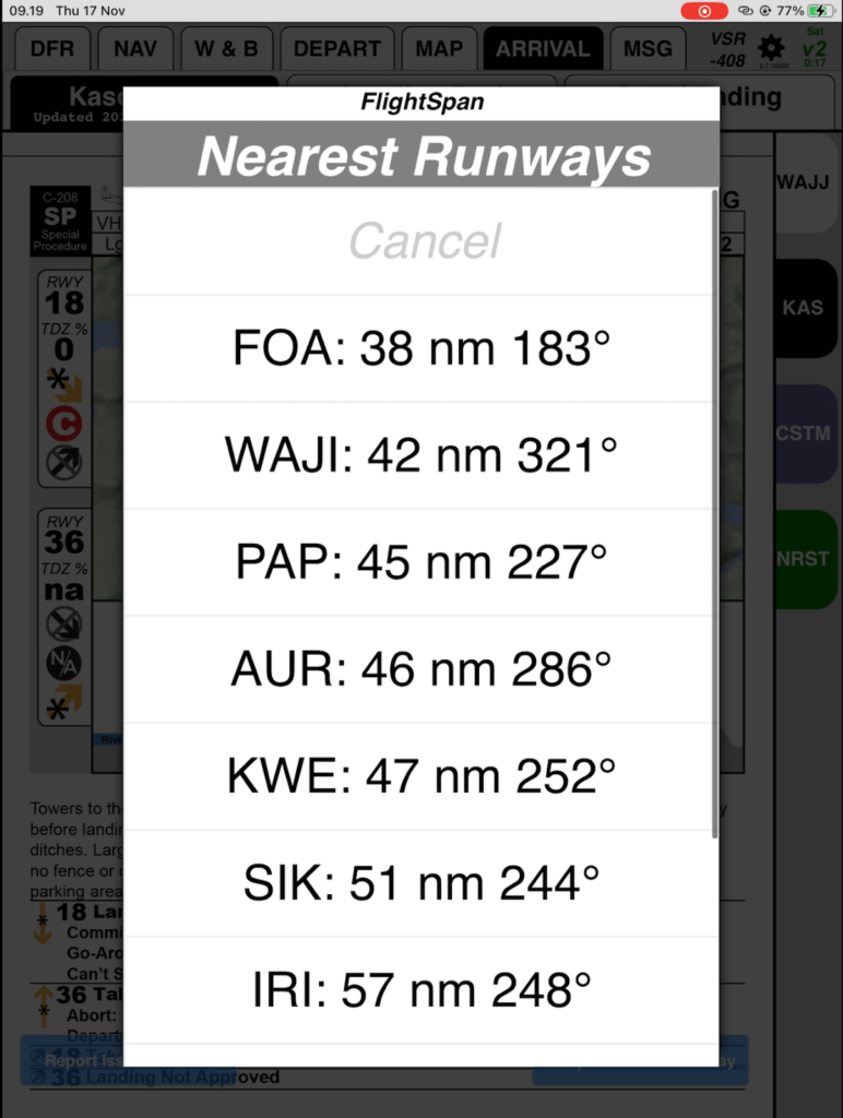
You will be given the option of inserting the runway into your route or replacing your current destination.

If you choose Replace, it changes the Nav, DFR, W&B, DEPART, and ARRIVAL tabs by replacing your current destination. In this example, Direct FOA was selected while flying the WAJJ-KAS leg, eliminating KAS from the route.
Weight and Balance:
Performance:
If you choose Insert, the runway will be added to the DFR, NAV, W&B, DEPART and ARRIVAL tabs. In this case FOA was inserted while navigating to KAS.
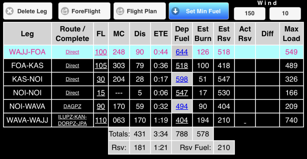
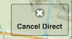
The Cancel Direct button, which appears when navigating Direct, switches your route from present position-direct to a line between your last waypoint and the waypoint you were just navigating directly to. It does not change the DFR or add your original destination back in.
Bottom
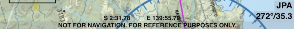
- Current Lat/Long
- Radial and distance from your departure waypoint, unless there is a navaid within 3 nm of your departure waypoint, in which case that navaid will be used.
- Chart warning – the moving map feature of FlightSpan is not approved for navigation and is provided as a reference only.
In the next lesson, you will learn how FlightSpan™ behaves during a flight, and the procedures to follow.
Video Version