
In this lesson you’ll learn several features that are unique to helicopters. Although weight and balance functions the same as fixed-wing aircraft, FlightSpan™ also calculates lateral CG, and your external-load envelope. FlightSpan™ calculates HOGE and HIGE for you, and also allows you to create and or edit LZs at any time. You’ll plan shuttles from Noiadi where you previously cached fuel to the (fictional) mountain village of Ambalia.
Create a New DFR
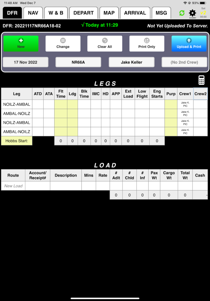
From the DFR tab, manually create a DFR using the techniques described in Getting Started.
- Select NR66A as your aircraft to enable the helicopter features.
- Select Jake Keller as your pilot so the weight and balance numbers match the examples.
- Your route is NOILZ-AMBAL-NOILZ-AMBAL-NOILZ.
Add/Edit LZs
First, you want to make NOI a refueling point so you can carry max load on the shuttles. To do that, you’ll edit the existing helicopter LZ.
On the NAV tab, the Delete Leg button changes for helicopters to Add/Edit LZ.
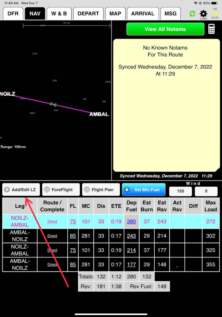
Or from the route planner screen tap the Add/Edit LZ button.
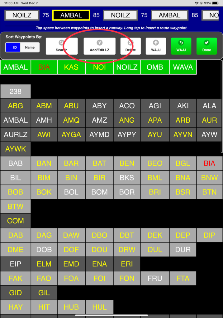
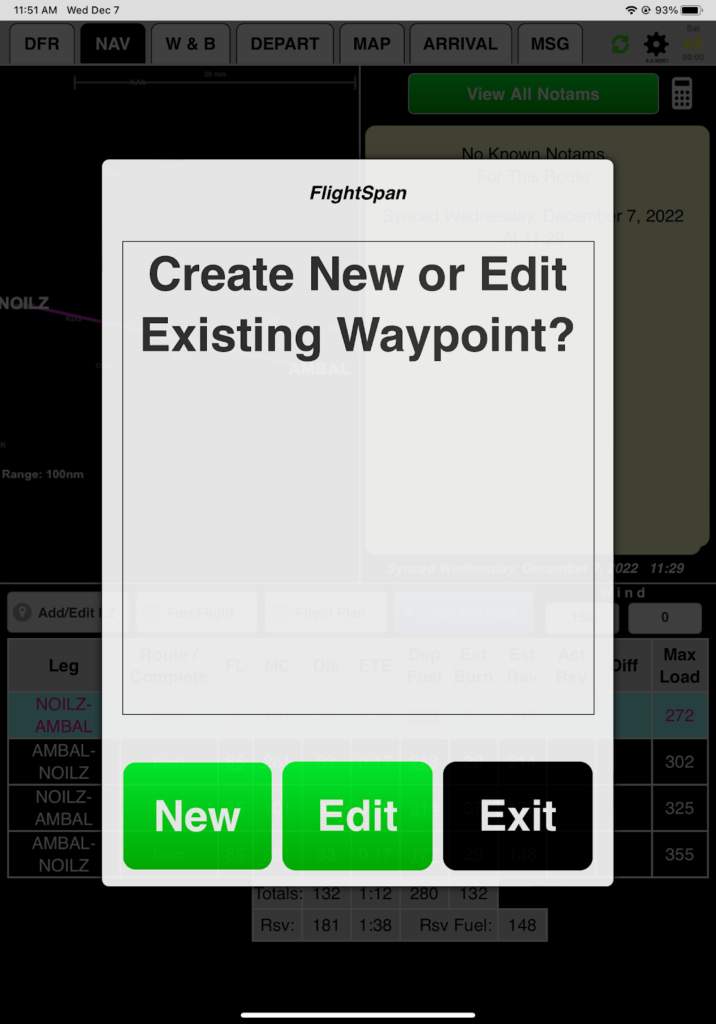
Select Edit
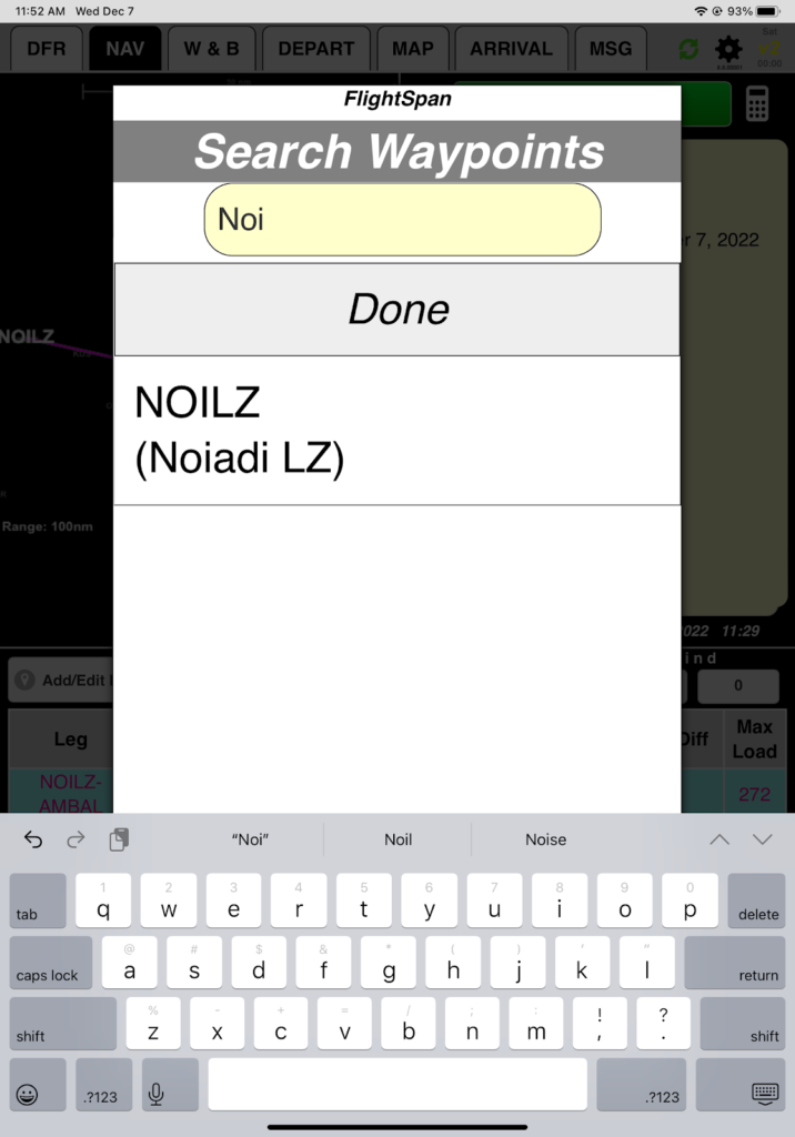
Search Waypoints and select NOILZ. Note only helicopter LZs will appear – en route waypoints do not.
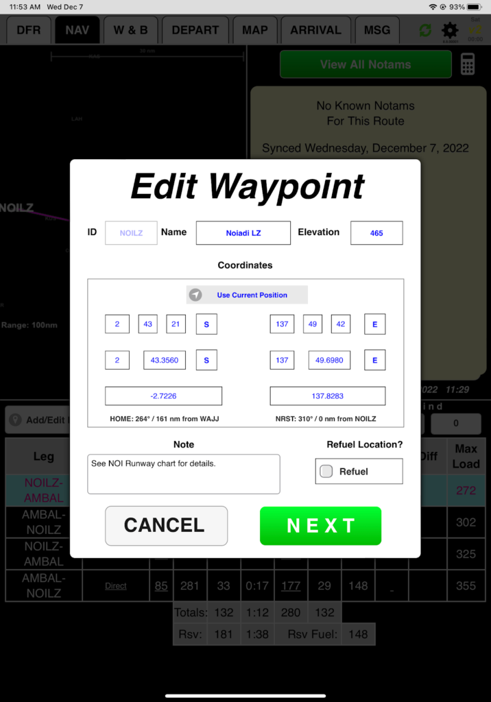
From the Edit Waypoint window you can:
- Edit the Name (but not the identifier)
- Edit the Elevation
- Edit the Position either manually or by tapping the Use Current Position button (requires valid GPS position).
- Add or edit Notes
- Designate it as a Refuel Location
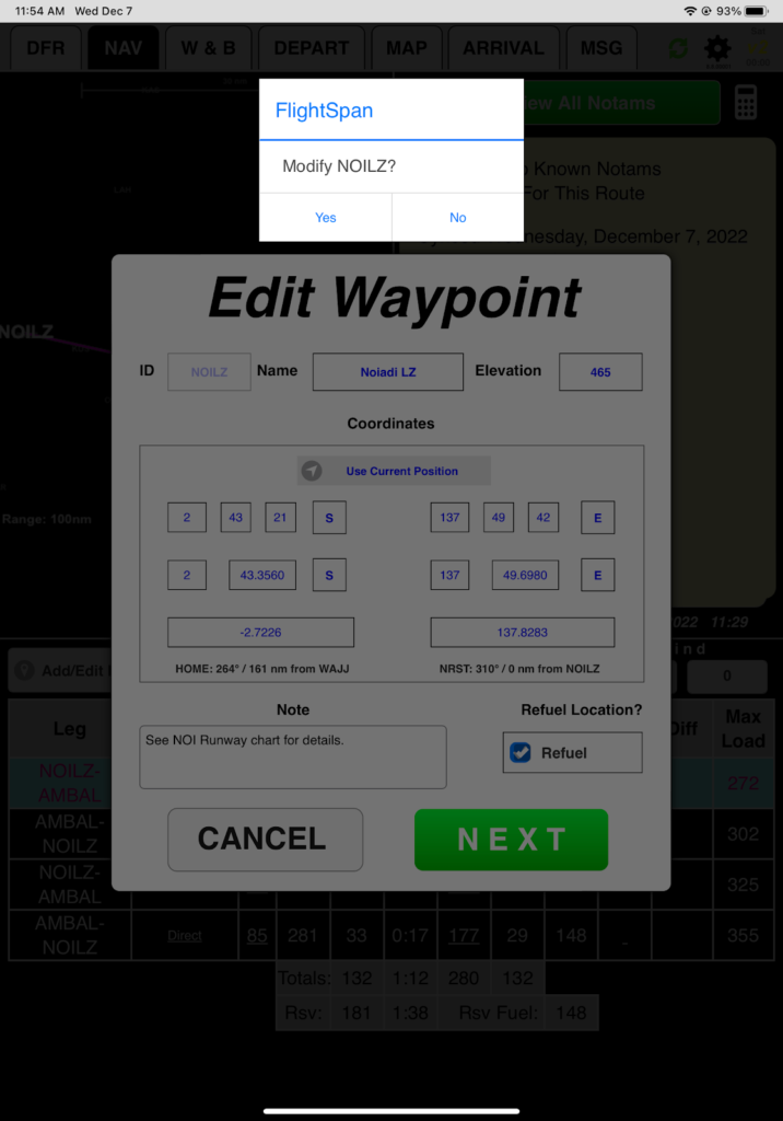
Go ahead and designate NOILZ as a Refuel Location and tap Next and confirm you want to modify the waypoint. This will enable the Min Fuel function to work on the NAV tab.
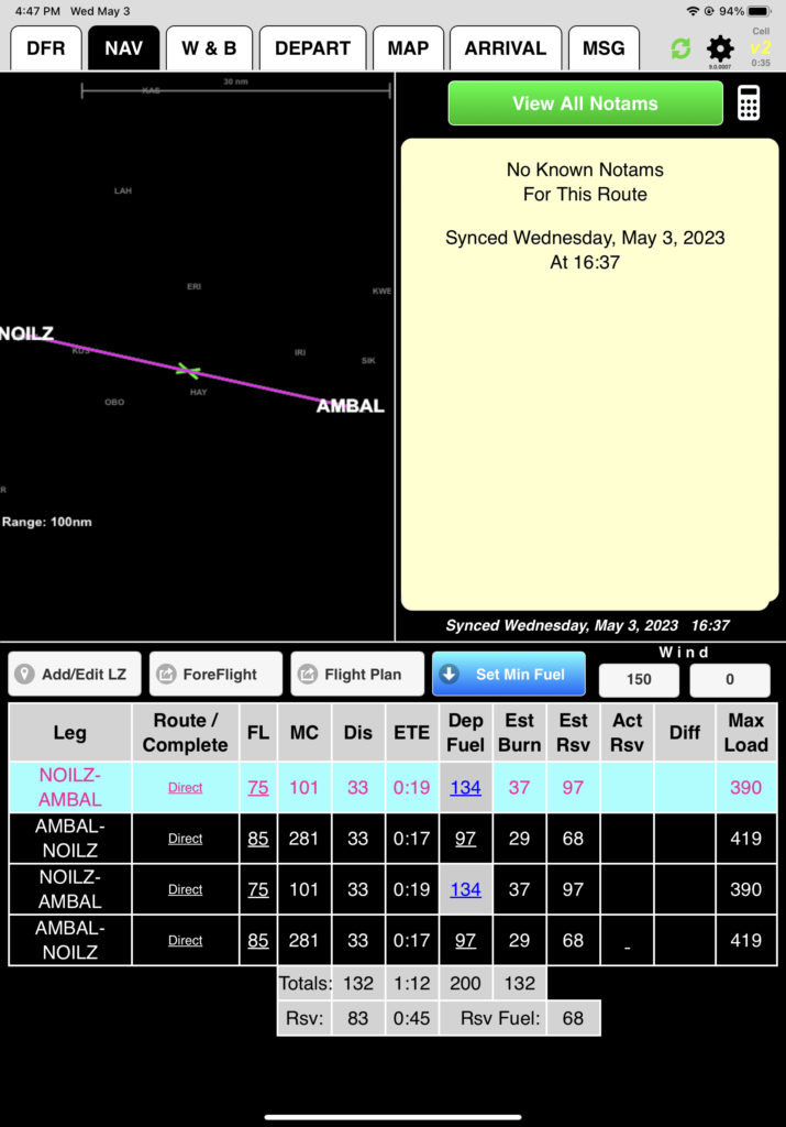
From the NAV tab, tap Set Min Fuel. Since NOILZ was designated a Refuel Point, FlightSpan™ will calculate minimum fuel of 68 liters for each arrival at NOILZ.
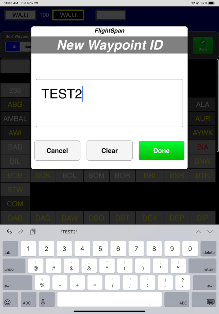
You can also create a new LZ by selecting New instead of Edit.
Give the waypoint a unique 5 letter identifier and tap Done. Once you have saved the new waypoint, you won’t be able to change the identifier except from FlightSpan™ Ops.
Give the waypoint an identifiable name

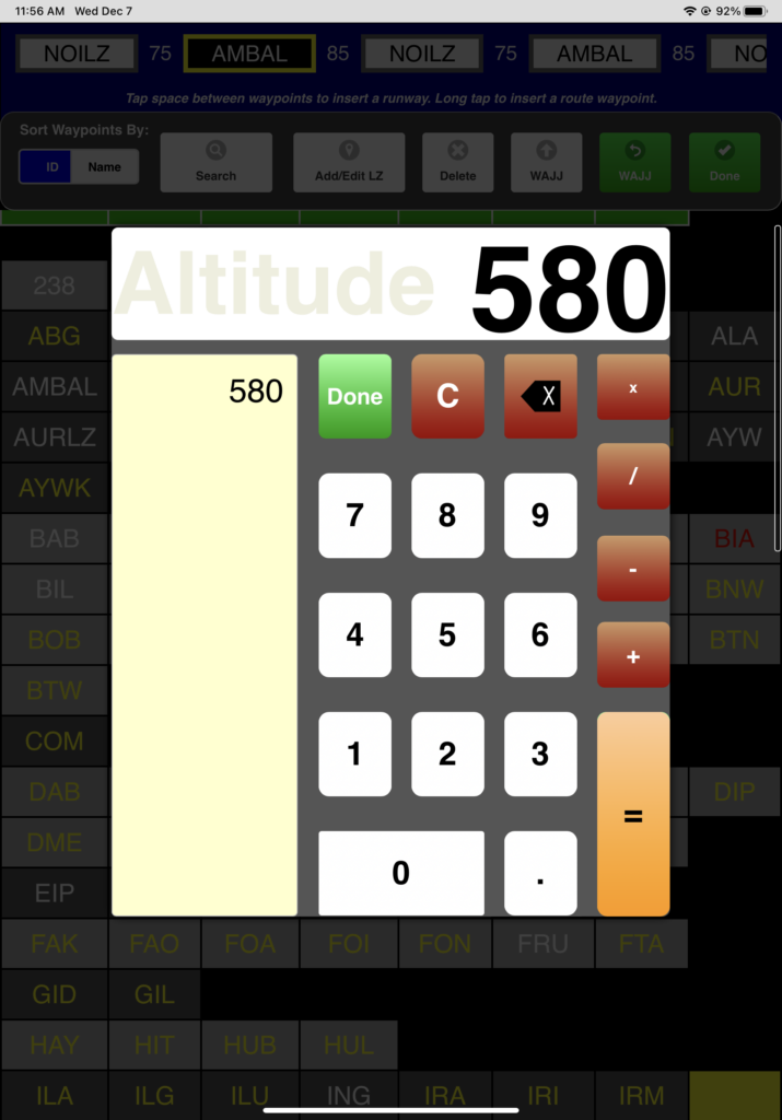
Enter the altitude
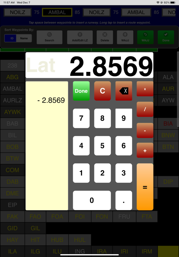
Enter the position
- Tap Use Current Position or
- Enter the Lat/Long manually. Lat/Long can be entered in Degrees/Minutes/Seconds, Degrees/Decimal Minutes, or Decimal Degrees. Use negative for Southern and Western hemispheres.
Enter any desired notes, decide whether to make it a Refuel Location, and tap NEXT.
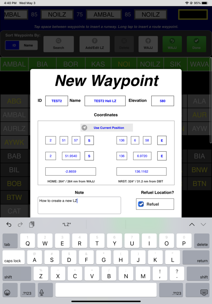
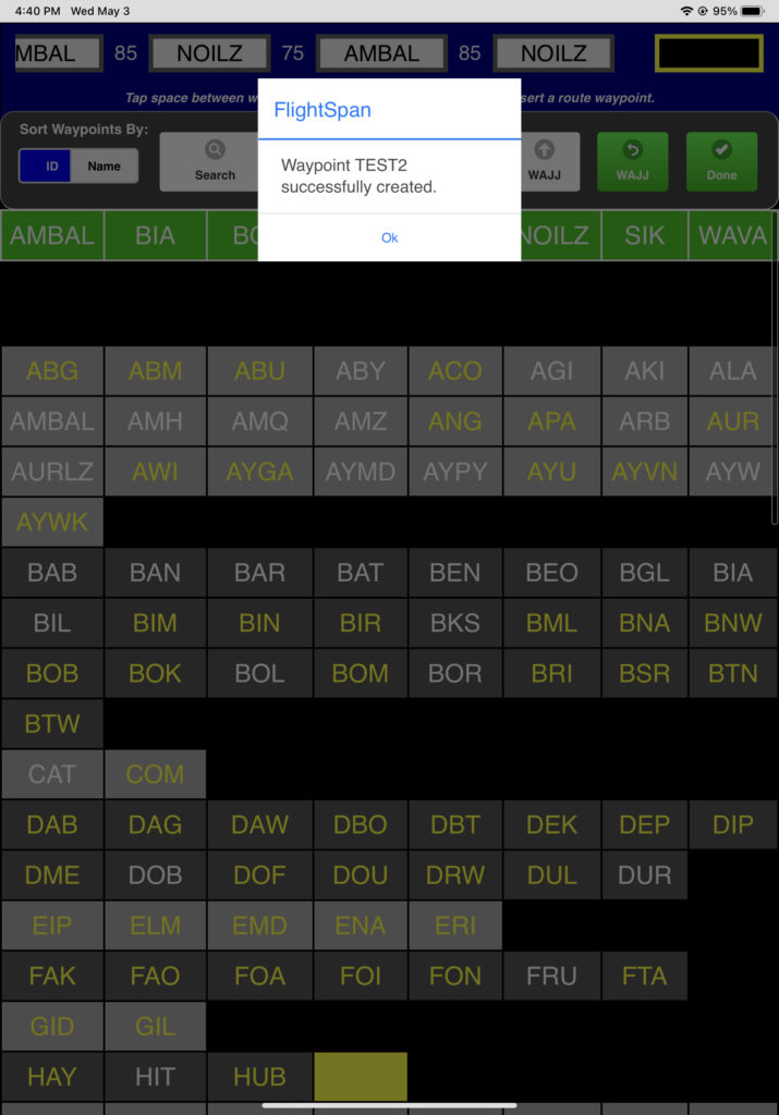
You’ll receive a confirmation message. If you are connected to the internet, the waypoint will be immediately uploaded to FlightSpan™ Ops, and will be available to other iPads. If the iPad does not have an internet connection, the waypoint will be uploaded to FlightSpan™ Ops when you upload your DFR or when the next data sync is performed.
Video Version