The Nav tab is divided into three main sections:
- Route
- NOTAMs/Weather/Fuel
- Flight Planning
Route Map
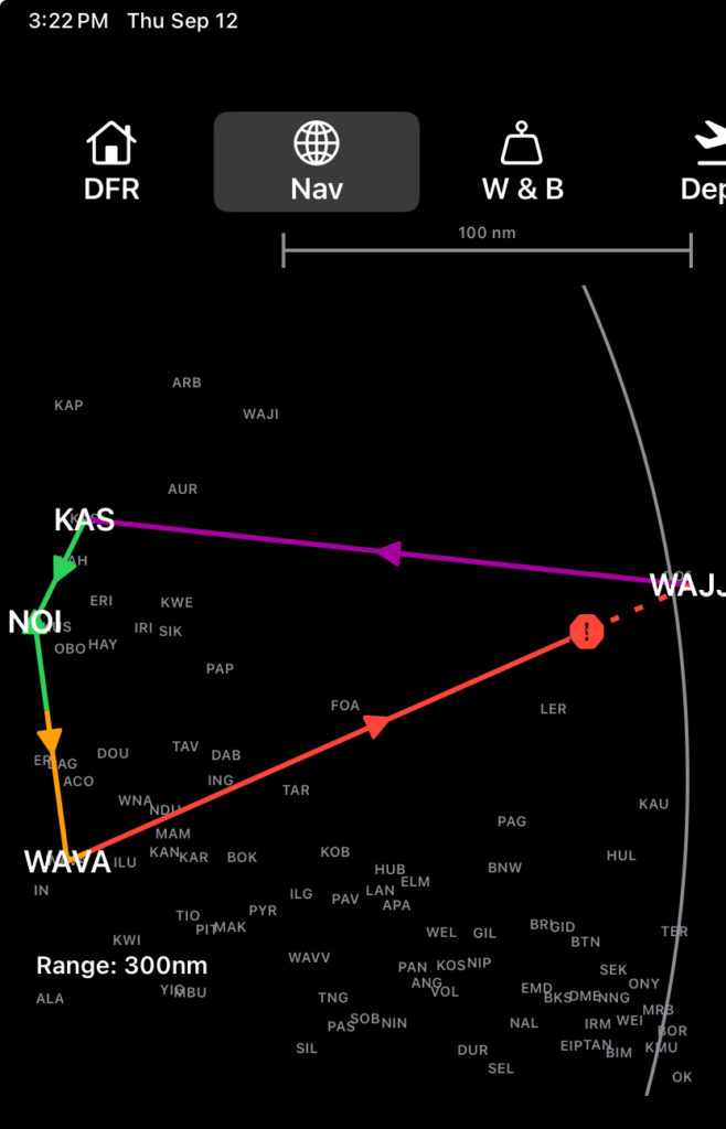
Route legs and icons are color coded to indicate leg and fuel status:
- A magenta arrow and line is the selected/active leg with an estimated landing fuel above your company’s level one fuel reserve quantity
- A green arrow indicates a non-active leg with an estimated landing fuel above your company’s level one fuel reserve quantity
- If the initial part of a route line is green then transitions to orange, the transition point indicates the estimated point at which the EFB predicts company level one fuel reserve quantity will be reached.
- An orange arrow indicates a leg where the estimated landing fuel will be below your company’s level one fuel reserve quantity, but above the level two fuel reserve quantity
- A red arrow indicates a leg on which the estimated landing fuel will be below your company’s level two fuel reserve quantity.
- The transition point on a route line between orange and red indicates the estimated point at which the EFB predicts company level two fuel reserve quantity will be reached.
- A red stop sign with an exclamation point indicates the estimated point where the EFB predicts fuel exhaustion will occur
- A dashed red line is used for any part of a route after the estimated fuel exhaustion point
NOTAMs, Weather, and Fuel
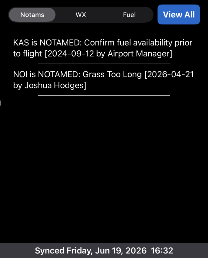
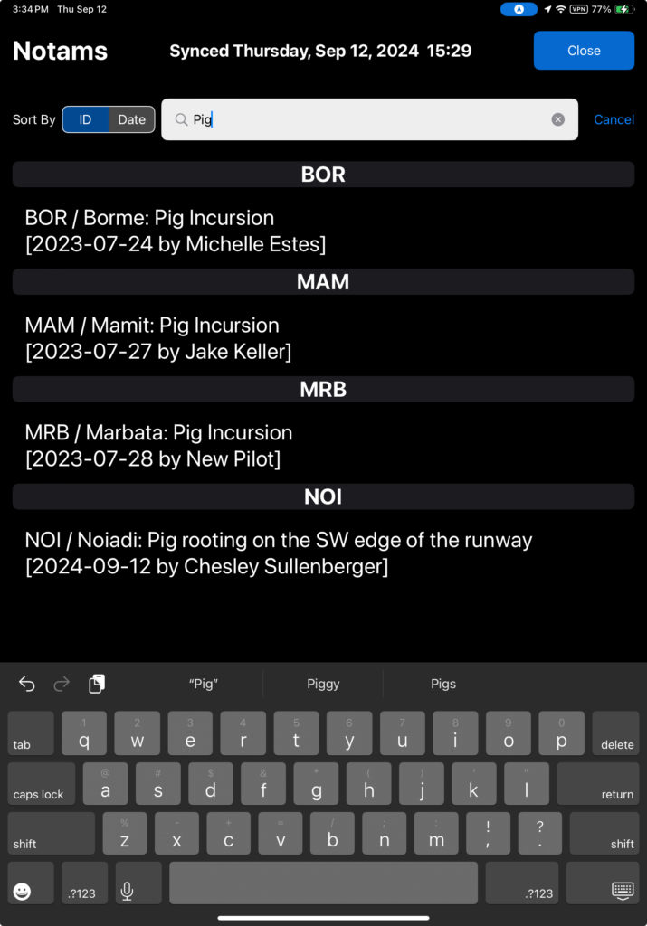
NOTAMs for all runways on your route will be displayed in the NOTAMs section. If a runway in your route has not had recent operations by your company, an automatically generated ‘No Recent Operations’ notification will be included in the list.
Tap View All to see a list of all company NOTAMs.
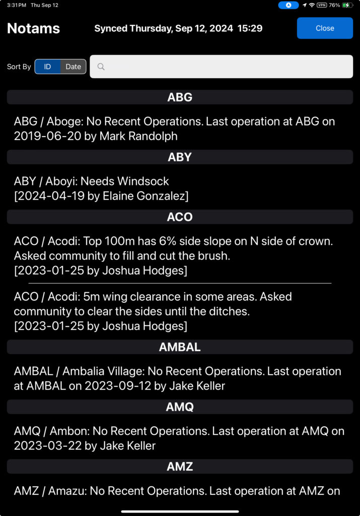
NOTAMs can be sorted by airport ID or date.
Search by airport name, ID, date, content of the NOTAM, or name of the reporting person.
Tap WX to view all METARs and TAFs in your route.
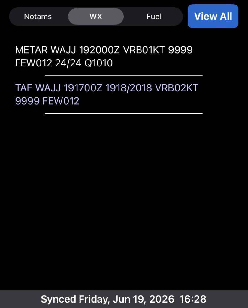
Note: METAR and TAF data is downloaded to the EFB when you are connected to the internet. In flight, the data is not refreshed unless you have an internet connection.
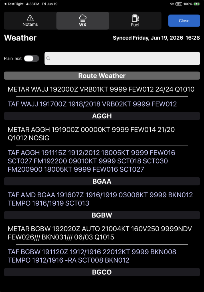
Tap View All to see all METARs and TAFs.
Destinations included in your route will be listed first under Route Weather in the order of your route, followed by all other locations listed alphabetically.
Tap the search bar to search for a destination.
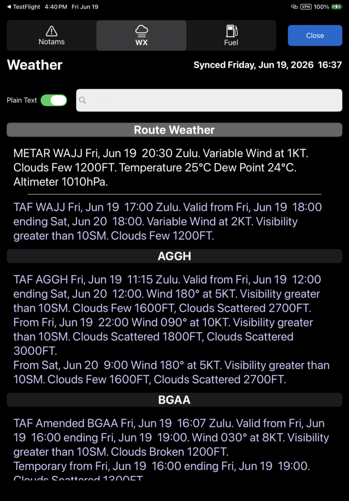
Toggle the Plain Text button to view a plain language version of the weather.
Tap Fuel to see the status of fuel caches at airports included in your route.
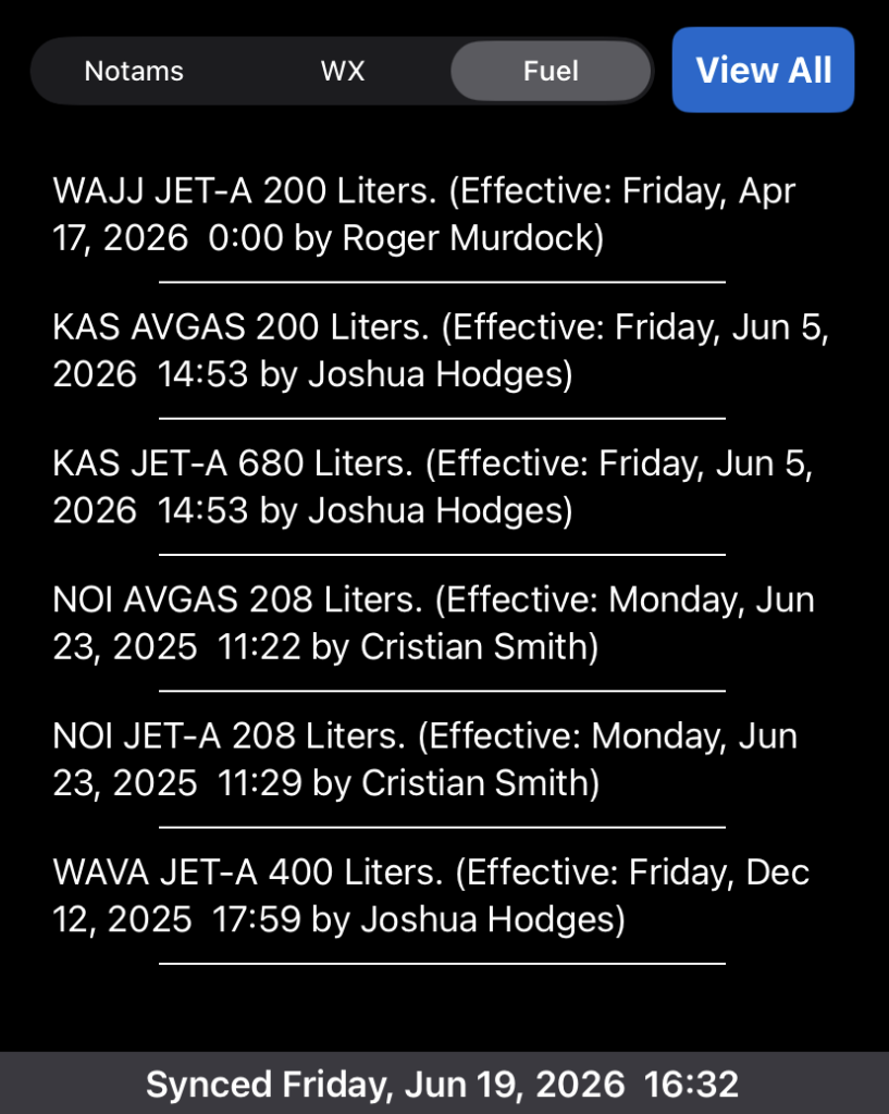
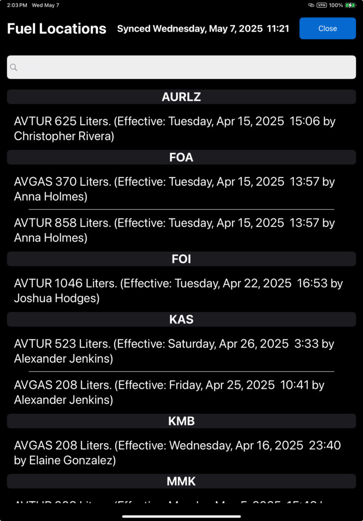
Tap View All for a complete listing of fuel caches.
The fuel quantity is a sum of all fuel owners at each location.
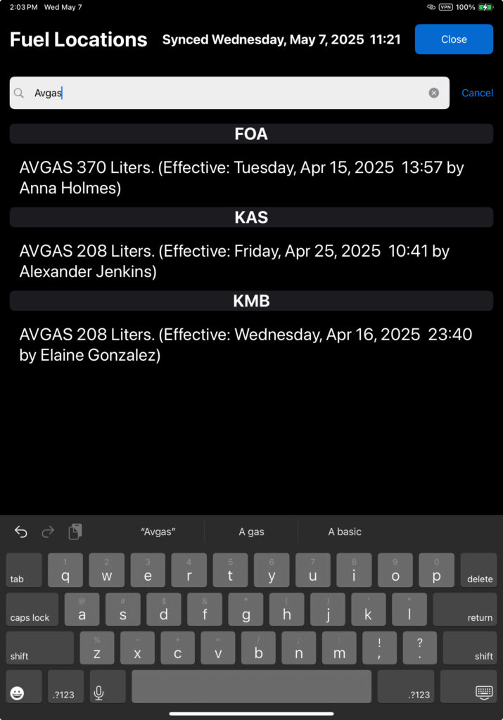
Use the search bar to narrow the list based on any criteria in the fuel listing.
Video Version